With the growing number of LEO satellite mega-constellations, you might be curious what sort of coverage you could expect in your current location. I wrote a small CLI tool which gives an idea of what coverage looks like from the OneWeb or Starlink constellation in a given location, for a fixed number of hours in the future. It pulls the latest TLEs from Celestrak and propagates orbits using Skyfield. Coverage is approximated by the satellite in view with the highest altitude. An altitude of 90° means the satellite is directly overhead, an altitude of 0° means it’s on the horizon.
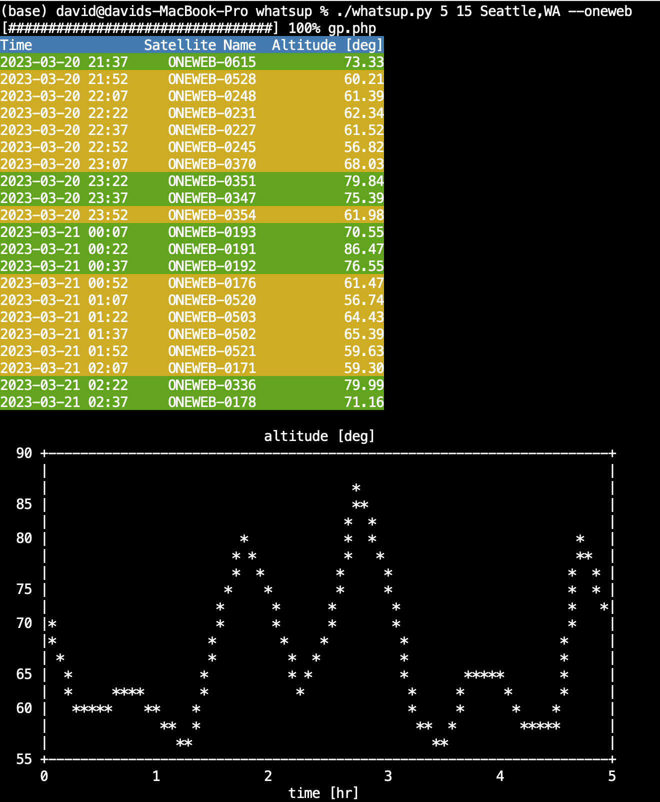
In my location, Seattle, at the time I wrote this post, the output looks like this for OneWeb:
And this for Starlink:
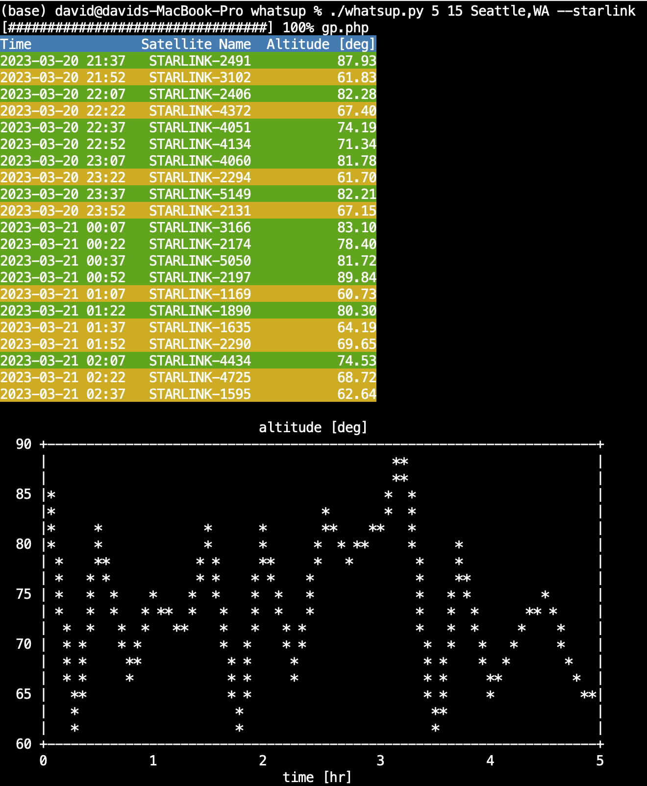
Keep in mind higher altitudes are preferable, as the satellite is less likely to be obstructed by trees or buildings and the connection will pass through less atmosphere, incurring less RF loss along the way. As you can see from the images above, Starlink has somewhat better coverage which isn’t surprising given the relative size of their constellations.
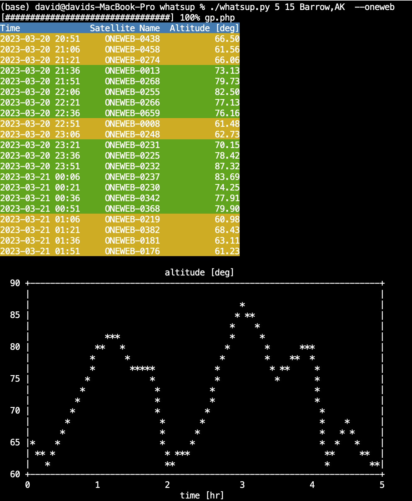
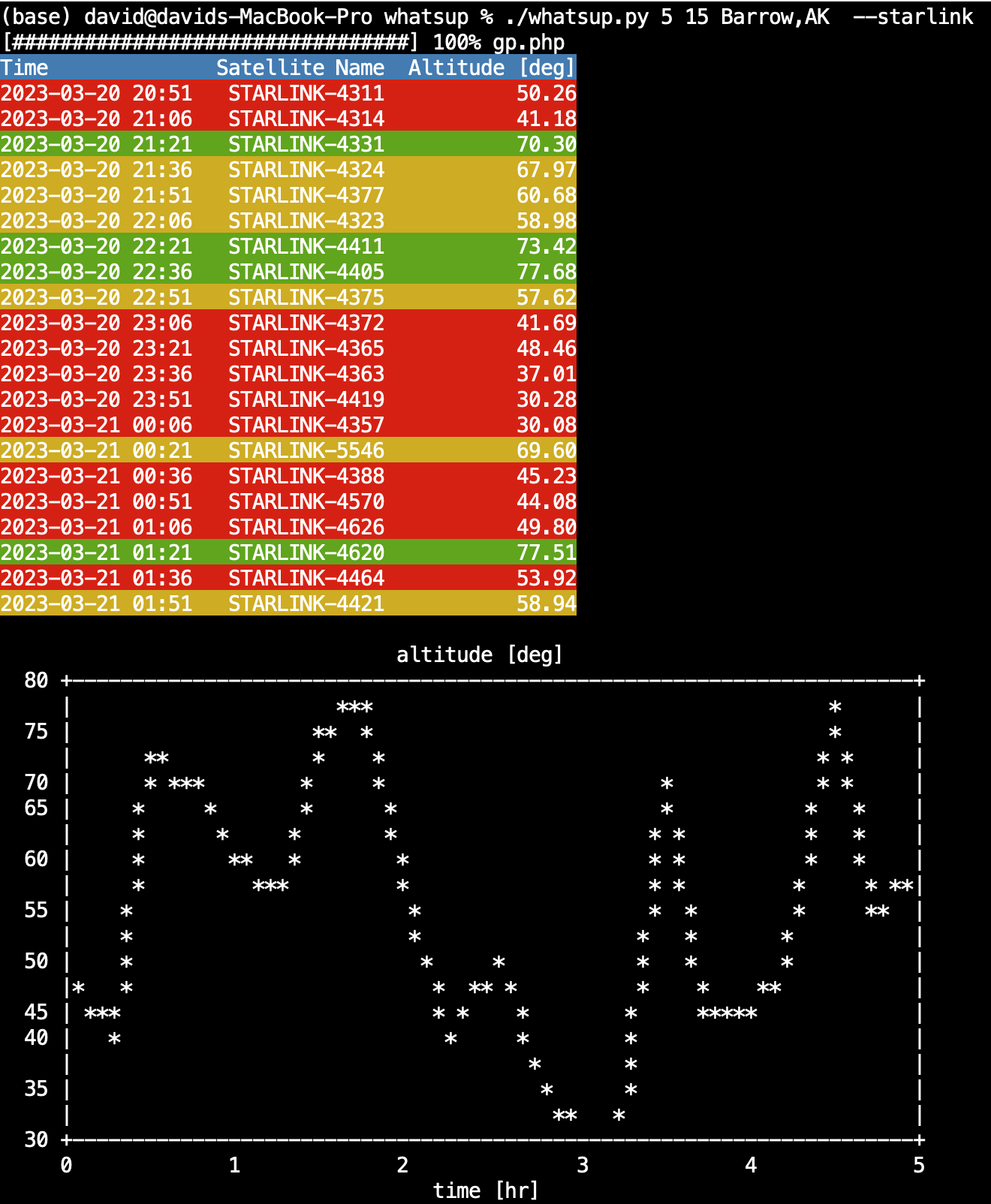
However, because OneWeb satellites have a high inclination orbit (86.4°), they provide great coverage in the far north/south. For example, if you live in Barrow, Alaska the situation is quite a bit different.
OneWeb:
Starlink:
Anyway, I hope others find the tool (https://github.com/friedman101/whatsup) useful. I’ll probably add more constellations as they come online.